LANDFORMS – GEOGRAPHY NOTES
A landform is a feature on the Earth’s surface that is part of the terrain. There are major landforms such as Mountains, Plains, Hills and Plateaus. Minor landforms include buttes, canyons, valleys, and basins.
TYPES OF LANDFORMS
Mountains
Mountain is a natural elevation of the earth’s surface
Four main types of mountains
FOLD MOUNTAINS
When the two plates move towards each other again, the layers of sedimentary rock on the sea floor become crumpled and folded.
(eg) The Akwapim ranges are fold mountains of the Togo series rocks, forming the eastern boundary of the Voltain sandstone basin. They stretch from the west of Accra and run in a north-easterly direction, through Togo and Dahomey, into the Niger River valley. The average elevation is 450 m above sea level and the highest altitude in Ghana, Mount Afadjato (890 m), is found here.
BLOCK MOUNTAINS
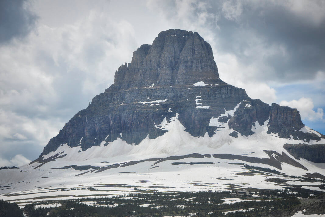
Fractures in the Earth’s surface, result in formation of fault-block mountains.
These mountains are formed when great block of earth’s crust may be raised or lowered.(eg) Vindhya and Sathpura in Madhya Pradesh.
VOLCANIC MOUNTAINS
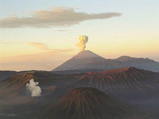
Overlapping lava flows and layers of consolidated volcanic dust, called tuff, are responsible for the formation of volcanic mountains. Such stratified volcanoes occur in the Pacific Northwest of North America and in Japan. They are typically steep-sided cones that are built up around a central vent.Mt.Kilimanjaro in Africa and Mt.Fujiyama in Japan are examples of such mountains.
 FIGURE: Volcanic Mountains
RESIDUAL MOUNTAINS
Residual mountains are formed as a result of erosion of an existing elevated area. They are also called mountains of denudation.(eg) Nilgiris in Tamil Nadu
LIST OF FAMOUS MOUNTAIN RANGES
| Rank | Range | Continent | Approx. length | Max. elevation | Highest point |
| 1 | Andes | South America | 7,000 km | 6,962 m (22,841 ft) |
Mount Aconcagua
|
| 2 | Southern Great Escarpment | Africa | 5,000 km | 3,482 m (11,424 ft) |
Thabana Ntlenyana
|
| 3 | Rocky Mountains | North America | 4,800 km | 4,401 m (14,440 ft) | Mount Elbert |
| 4 | Transantarctic Mountains | Antarctica | 3,542 km | 4,528 m (14,856 ft) |
Mount Kirkpatrick
|
| 5 | Great Dividing Range | Australia | 3,500 km | 2,228 m (7,310 ft) |
Mount Kosciuszko
|
| 6 | Himalayas | Asia | 2,576 km | 8,848 m (29,029 ft) |
Mount Everest
|
PLAINS
When the stream beds turn gentler due to continued erosion, downward cutting becomes less dominant and lateral erosion of banks increases and as a consequence the hills and valleys are reduced to plains.Generally, plains are very fertile. Construction of transport network is easy. Thus, these plains are very thickly-populated regions of the world. Some of the largest plains made by the rivers are found in Asia and North America. For example, in Asia, these plains are formed by the Ganga and the Brahmaputra in India and the Yangtze in China.. In India too, the Indo-Gangetic plains are the most densely populated regions of the country.
STRUCTURAL PLAINS
Structural plains are relatively undisturbed horizontal surfaces of the Earth. They are structurally depressed areas of the world that make up some of the most extensive natural lowlands on the Earth’s surface.
EROTIONAL PLAINS
Fromed when elevated tracts of land are wornedby the process of erotion. Deposition develops a floodplain just as erosion makes valleys. Floodplain is a major landform of river deposition. Large sized
materials are deposited first when stream channel breaks into a gentle slope. Thus, normally, fine sized materials like sand, silt and clay are carried by relatively slow moving waters in gentler channels usually found in the plains and deposited over the bed and when the waters spill over the banks during flooding
above the bed. A river bed made of river deposits is the active floodplain. The floodplain above the bank is inactive floodplain.
A coastal plain is a stretch of lowland along a seacoast which slopes toward the sea.
PLATEAUS
Plateaus are elevated flat lands. They are a flat-topped table land standing above the surrounding area.Plateaus are very useful because they are rich in mineral deposits. As a result, many of the mining areas in the world are located in the plateau areas.
The biggest, tallest plateau in the world is the Tibetan Plateau. A plateau with a lot of erosion is called a dissected plateau. A plateau that is also a volcano is called a volcanic plateau. Some plateaus are under the ocean, like the Seychelles plateau.
LIST OF FAMOUS PLATEAUS
| Name of Plateau | Location |
| Ahaggar Plateau | Algeria |
| Altiplano Plateau or Bolivian Plateau | South-eastern region of Peru and western region Bolivia |
| Anatolian Plateau | Turkey |
| Bavarian Plateau | Germany |
| Colorado Plateau | Southwestern part of USA |
| Columbia – Snake Plateau | Washington, Oregon, and Idaho (USA) |
| Deccan Plateau | India |
| Katanga Plateau | Democratic Republic of the Congo |
| Kimberley Plateau | Australia |
| Laurentian Plateau | Canada |
| Loess Plateau | China |
| Mascarene Plateau | Indian Ocean |
| Massif Central | France |
| Mexican Plateau | Mexico |
| Patagonian Plateau | Argentina |
| Pothohar Plateau | Pakistan |
| Spanish Plateau or Iberian Plateau | Spain |
| Tibetan Plateau | Central Asia |
WORLD GEOGRAPHY COMPLETE NOTES
REFERENCES
http://www.bbc.co.uk/schools/gcsebitesize/geography/natural_hazards/fold_mountains_rev1.shtml


